Bandelier Cliff Dwellings & Valles Caldera
Dwelling in the Cliffs — Our daytrip to Bandelier National Monument and Valles Caldera
In order to keep from moving up a weight class (or two), Team EatingNewMexico decided to take Labor Day weekend off from our culinary exploits and get in some much needed hiking. We chose to brave the crowds and drive to Bandelier National Monument, a beautiful, federally protected preserve about two hours north of Albuquerque. Bandelier is famous for the cliff dwellings, village ruins, petroglyphs, kivas, and other artifacts of the Ancestral Pueblo people, who occupied the area approximately 500-900 years ago.
If you’ve been to Bandelier in the past, but it’s been a while, you should know that the rules have changed when it comes to driving and parking at the monument. Unless you’re an early bird (arriving before 9:00 a.m.) or a late-comer (arriving after 3:00 p.m.), you won’t be allowed to drive yourself to the park. Visitors arriving between 9:00 and 3:00 have to park in the town of White Rock and take the shuttle bus into Bandelier. White Rock is about 12 miles away from the park entrance, and the bus ride takes around 20-25 minutes.
The Visitor’s Center and shuttle bus terminal in White Rock were well marked and very easy to find. We arrived in White Rock around 10:30 AM, and in spite of the Labor Day crowds, there was ample parking available. The Visitor’s Center had a helpful and friendly staff, and clean restrooms. There was a shuttle leaving every 20 minutes, so we had plenty of time to hit the restroom, change into our hiking boots, and liberally apply sunscreen before we jumped on the bus.
Since it was Labor Day weekend, the park was crowded and the full-sized buses filled up to “standing room only” very quickly. Upon boarding the bus, the driver informed us that there would be two stops. The first stop would be at the Frey Trailhead / Juniper Campground, which would allow visitors to make a 1.5 mile hike to the Bandelier Visitor’s Center along a well-marked trail. The second stop would be at the Visitor’s Center, for those unwilling or unable to make the hike.
When we arrived at the Frey Trailhead, we expected a mass exodus from the extremely crowded bus; however, only three people chose to make the hike: me, Zia, and Zia’s eight year-old daughter. We thought that was a little odd, but at the same time enjoyed a bit of self-righteousness at being the only ones who dared to hike in rather than be bussed in…or did everyone else know something that we didn’t???
The Frey Trail
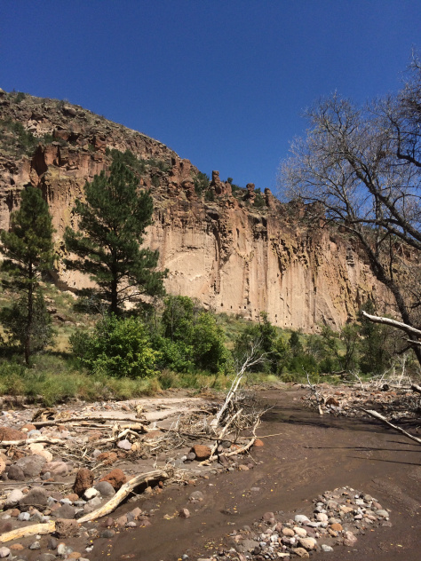
As it turns out, leaving the bus to hike in via the Frey Trail was a great idea. The trail is well marked and provides good, even footing. The only significant terrain is over the last half-mile, as the trail descends through a series of switchbacks into the valley floor where the Visitor’s Center and old Tyuonyi (Que-WEH-nee) Pueblo ruins are located. During the descent, we were rewarded with a beautiful view of the valley floor and the surrounding high ground. We felt very fortunate that we had this view and experience all to ourselves, as we were the sole hikers on the trail.
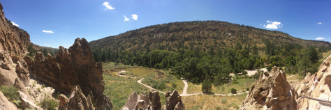
Bandelier Visitor’s Center
The hike in from the Frey Trailhead left us feeling a little hot and parched (we did pack along some water bottles, but we were ready for something a little colder, preferably something with bubbles poured over ice, like, preferably a Dr. Pepper). The Visitor’s Center at Bandelier offered us a short hiatus from the hot sun. There were restrooms, air conditioning, and a friendly staff on hand ready to answer our questions. We paid our park fee ($12 per car, or since we didn’t have a car, per “group of people that would fit in a car”) with a credit card, but in order to purchase a village map ($1), we needed cash. Neither of us had any cash, but the staff was happy to provide us with a “Loaner Map,” which we returned at the end of our visit.
Adjacent to the Visitor’s Center is a Gift Shop and Snack Bar. The snack bar offers an ok variety of pre- and post-hike fare. There are trail mixes, candy, chips, beverages (bottled and fountain), as well as some over-the-counter cooked foods like hot dogs! (They’re “Nathan’s” hot dogs, too. And yes, we shared one!) Even though we had packed along our own water and trail mixes for the hike, the Visitor’s Center Snack Bar was a nice respite from the heat, and it allowed us to recharge from the hike in.
Next, we set off on the Main Loop Trail, a paved 1.2-mile roundtrip route that leads to the Tyuonyi ruins, the cliff dwellings, the Long House, and eventually on to another trail, which leads to the Alcove House site.
The map we borrowed proved very useful. Each feature along the trail is marked with a wooden numbered marker, and you can open your map to the corresponding number and read a description and history of what you’re seeing. I highly recommending purchasing or borrowing a map for touring the area.
The Sites
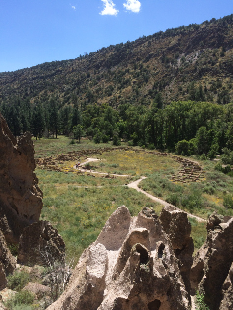
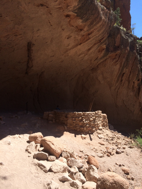
The first major site along the Main Loop Trail is the Tyuonyi Pueblo Ruins. Passing through this village, it’s easy to let your mind travel back in time to the 12th and 13th century when this Ancestral Pueblo community thrived. According to the map/guidebook, these ruins were once called “Anasazi” ruins, but the name was changed to “Ancestral Pueblo” because Anasazi actually translates to “Ancient Enemy.” The Tyuonyi ruins are laid out in a circle, and once stood 2-3 stories tall. The rooms themselves are very small — each only slightly larger than a king-size bed, and were probably mostly used to store food and supplies. In the center of the circle were 3 kivas (underground pit structures used for religious ceremonies, teaching, and other community functions). One of the kivas has been excavated and maintained while the other two are only slightly visible as indentations in the ground.
Even though there were a lot of visitors while we were there, the trail system throughout the valley is large enough to keep the crowd thinned out. The only place we were near other sightseers was at the cliff dwellings themselves, where there was usually a short queue waiting to ascend one of the ladders and explore the inside of the dwellings.

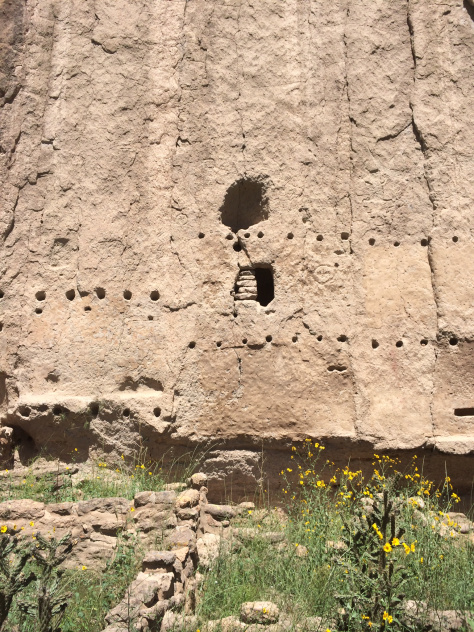
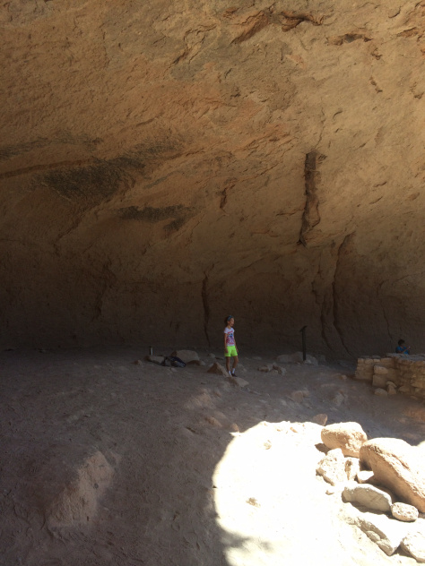
The cliffs in this area (the Pajarito Plateau) are actually hardened volcanic ash (called “tuff”) deposited over a million years ago during a massive volcanic explosion in the nearby mountains. Over time, wind and rain eroded the softer areas of the tuff, creating holes and caverns. The Pueblo people used hand tools to carve out the holes for their dwellings. These are called cavates (CAVE-eights). In some cases, small mud brick structures were built in front of the cavate openings to expand the dwelling.
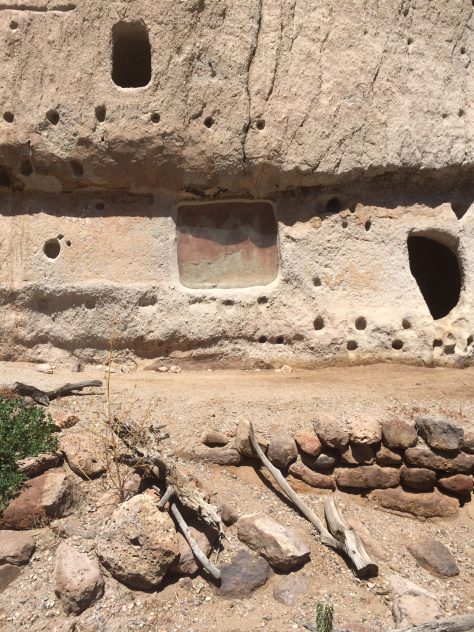
From the outside, we could see many of the centuries-old petroglyphs carved into walls. In the photo above, you can see a cave wall painting that was uncovered during excavation of one of the dwellings. The painting looked like a zig-zag pattern in red and brown hues. On the broad wall of the cliff, we spotted faces, turkeys, suns, and other various petroglyphs. The horizontal rows of smaller holes show where floors & ceilings were located.
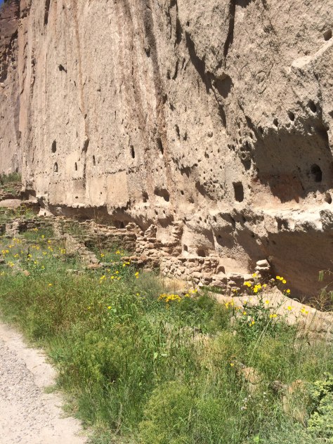
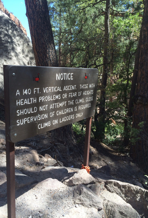
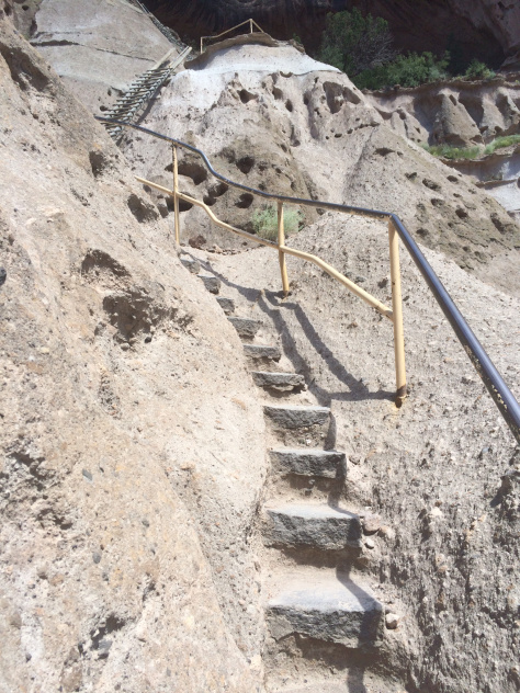
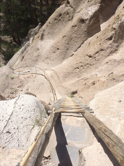
Beyond Long House is a fork in the road. You can either turn left and go back to the Visitor’s Center or turn right and walk about 1/2 mile to the Alcove House. The Alcove House is a large, open cave (aka an alcove!) in the cliff about 140 feet above the valley floor. The trail to Alcove House wanders along the Frijoles Creek basin. It’s well shaded by the trees and offers a nice break from the hot sun alongside the cliff dwellings. To enter the alcove, you ascend a series of narrow stairs carved into the cliff and four well-worn (but plenty sturdy) wooden ladders. While this is nowhere near as scary as it sounds, people with a fear of heights could experience some anxiety about the climb and the descent. However, the view from the alcove is worth the climb.
Overall, we spent about three hours in the valley. After we felt like we’d seen all there was to see (without setting off on a whole new hike), we walked about a mile back to the Visitor’s Center and had another run on the Snack Bar. Here, we decided to hop a bus back to White Rock rather than hike (UP) the Frey Trail back out. We wanted to save some daylight for our next stop…the Valles Caldera!
NOTE: There are many other things to see at Bandelier — other ruins, dwellings, and cave paintings — plus many other long and short trails. See their website for a full list of trails and things to see. Bandelier National Monument – More Info
Valles Caldera
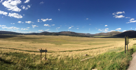
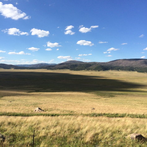
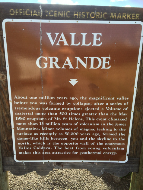
About 30 minutes west of White Rock along Highway 4 is one of the most breathtaking sights I’ve seen in New Mexico, the Valle Grande of the Valles Calder, a 13.7 mile wide volcanic caldera in the Jemez Mountains. (http://www.vallescaldera.gov/) The caldera was formed over a million years ago when the magma chamber of a volcano collapses in on itself after eruption, forming a bowl-shaped (or cauldron, “caldera” shaped) indention. There are areas within the caldera where magma is less than five miles below your feet.
Sadly, since this was a day trip and we still had to drive back to Albuquerque, we didn’t have a lot of time to explore the caldera. We did venture into the Valle Grande by car and we stopped by the visitor’s center to check it out. According to their website, the Valles Caldera offers an array of activities throughout the year, to include horseback riding, fly fishing, mountain biking, and cross-country skiing, just to name a few. I’m sure we will be visiting here again in the future.
Culinary Adventures…
…or lack thereof. Like I said in the beginning, this was never meant to be an eating adventure. While we entertained some great ideas about stopping for dinner in Santa Fe on the way home, in the end, the wishes of the 8-yr-old won out, and we found ourselves enjoying some chili-cheese tots at the Los Alamos Sonic. Not our best “Eating New Mexico” moment, but hey, truth be told, those things are damn good.
Click for More Info: Bandelier National Monument – More Info