“So there’s no trail?” I ask, scratching at my legs. The waist-high grass is blowing in a sporadic breeze, making me itch. I swat at a tiny winged insect buzzing around my right ear. Then another, or maybe the same one. They’re tenacious, these bugs. I look up at our goal: Sandia Peak, 10,400 feet seemingly straight up from where I stand at the bottom of a ski slope. The thick green grass between us and our goal feels teeming with snakes. I look down. I can’t see my feet.
Too bad the ski lifts aren’t working. I could just take one of those up.
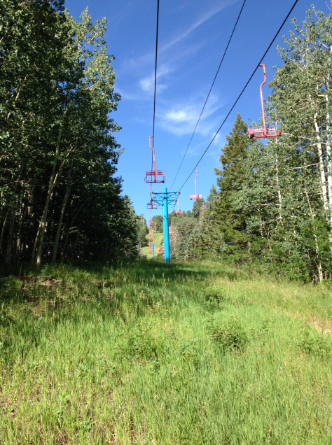
“Well, there’s a trail, somewhere,” Roadrunner admits. “But last time I just charged straight up the grassy part. The ski slope part.”
Of course you did.
“I’d rather take a trail,” I say, scanning the vicinity for some kind of marked or even unmarked bike or game trail. Somewhere where I can see my own feet and any snakes I might be about to step on. I also knew that any trail would switchback along the face of the mountain, giving me a better shot of completion than the near-90-degree (in my mind) straight-up “charge” that Roadrunner has planned.
“Ok, let’s find it.” Roadrunner sets off. Upward. Straight up the slope. In a “charging” fashion, some might say.
I follow, only hoping that he is scattering any wildlife (i.e., snakes) outward from his footsteps, rather than downward (i.e., toward me). We push on and up, through the waist-high grass, stopping now and then for me to catch my breath or just catch up. Finally, we happen upon a narrow dirt trail carved into the tall grass. About 18 inches wide, this must be the bike trail.
Hello, feet!
The bike trail cuts straight across the slope, so we can’t tell which way is headed up and which way is headed down. We randomly pick a direction, based mainly on which direction gets us to the shade quicker. Luckily, we pick the right direction and our trail starts switchbacking (switchingback?) upward, in the comfort and coolness and snakelessness of the dense pine shade.
Now and then we come back across one grassy ski slope or another and decide to plow upward across it to save some time (picture this as a shortcut between switchbacks), and all the while in the waist-high grass I’m wondering how many snakes I’m stepping on or near or over.
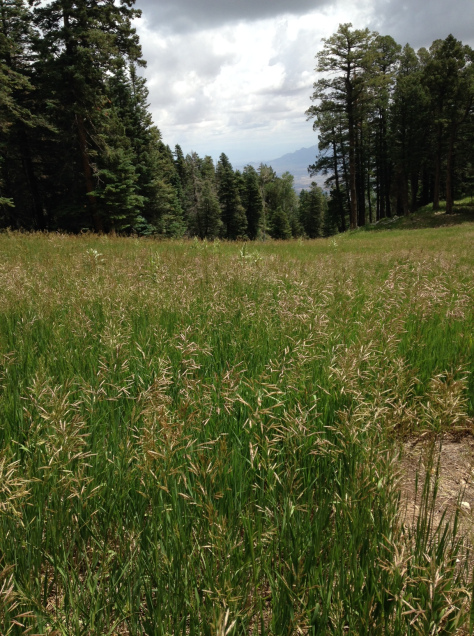
This goes on for a while. At some point we stop for a snack in the shade. Clementines, cashews, water.
Eventually, we come upon an area in a slope where the grass turns to rock and beyond that we can just see the shape of the mountaintop buildings emerging over the next ridge.
I make my way a few yards up the rocky area and have to stop and rest. I can’t seem to catch my breath so I stop and wait, leaning heavily on my trekking poles*. Gasping, you might say. Roadrunner comes back to make sure I’m not actually dying. “If I don’t make it,” I gasp, “feel free to eat me.”
I’ve read (and seen) ALIVE. I know how these things go.
He cheers me on, because he’s a good person. I climb another few yards, then stop to rest and catch my breath. Then one foot in front of the other. Try not to slip on the loose rocks because heaven knows if I slip, I’m slipping all the way to the bottom. This goes on for about another hour (or 10 minutes), until I finally, mercifully, exhaustifully crest the final outcropping and see the restaurant and outlook area we have been aiming at for the past 8 hours (or 2 hours).
Yay! Time to sit down, rest my lungs and legs, and have the one special treat I packed for this exact moment.
A 7 oz can of Dr. Pepper.
When I’m tired or sleepy or cranky, Dr. Pepper is my sweet elixir of life.
We sit (and I huff and puff and whine and probably swear a little bit) and drink our tiny Dr. Peppers. Just as I am starting to appreciate my accomplishment and feel pretty OK about myself, a co-ed group of young CrossFitters bounds up the steps and to the vista rail, looking out at the view, all smiles.
(I’m sure you can imagine them so I won’t describe them, but I will point out they bounded up the HARD SIDE of the hike, the front side, the La Luz trail side. Like it was nothing. And I’m pretty sure they weren’t breathing hard OR EVEN SWEATING.)
I try to keep my hatred for them inside.
After about 10 minutes sitting there, having a snack and recuperating, we get up to go look at the view, which is, some would think, why we came all the way up here in the first place. A few yards away is the top of the Tram station, and people pour forth from the little metal deathboxes -AHEM- I mean tram cars, with a regularity. For those unaware, the Sandia Peak Tram is an aerial tramway that covers almost 3 miles of rugged terrain and valleys, from the base near Albuquerque to the top of Sandia Peak (10,400 ft.). A trip on the tram takes about 15 minutes, and ends with much less huffing and puffing than the way we did it. But if you have issues with heights or claustrophobia, you might want to hike up.
Everyone getting off the tram wants to eat at the restaurant atop the mountain, High Finance, but it’s not open yet. So people are milling about, killing time. (For restaurant info click HERE. For Tram info click HERE.)
Roadrunner leads me away from the restaurant, down a rocky slope that looks a lot like the rocky slope I just trudged UP, and then parallel to the crest, toward a secret vista point. We step around a few small boulders and toward the edge.
We sit on a boulder and take in the view.
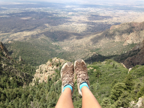

We can see all of Albuquerque, laid out in its neat criss-cross lattice of streets at right angles, and beyond to the volcanos of the West Mesa on the horizon. Far below us, in the tops of some trees that begin even farther below, a hawk and a raven soar and flap and survey.
And the sky opens up and goes forever.
This is why we’re up here.
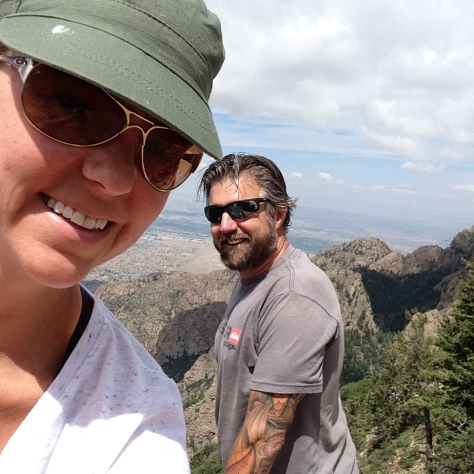
We need to get home so after about 10 minutes of rest, we head downward. Down is like up, but much faster and easier on the lungs. What it’s harder on are the quads and knees and toes. We charge down some of the grassy slopes, and take the switchbacks now and then to give our feet and knees a break. We make it down to where we started in about 45 minutes.
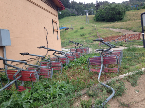
OVERALL I’d give this hike a bunch of stars on any kind of star system. It was really pretty (woods and grassy slopes in one hike) and the trail was fairly well marked in most places. Next time, I would probably start at a trail head and just stay on the trail and plan to take longer, rather than charging up the slopes to save time. I’d take away a star or two because I didn’t see any wildlife other than a squirrel, which is kind of a bummer.
*Author’s note: I completed this hike, from approximately 6,700 ft. – 10,600 ft. about 2 weeks after I moved to New Mexico from California (at sea level). I can say with certainty that I had not fully acclimatized to the altitude yet at this point. I don’t really recommend attempting this hike if you have just moved to the area after living at sea level. Get acclimatized then try it. Otherwise you will be sucking wind. Just saying.